Here’s a 2 mile bike ride that starts at Scenic and Edwards.
Choose an entry point and then travel the course clockwise. Biking clockwise will give you the most right hand turns, which are much safer than left hand turns. There are three left hand turns on this route. Please stop and make sure the coast is clear when you make a left hand turn.
Turn by turn directions starting at the corner of Scenic and Edwards. (You can join in anywhere along the route and follow the turns.).
L onto Scenic (head south)
R onto Spring Creek Dr
R onto Spring Meadows
R onto Beacon (head east)
R onto Scenic
L onto Wendover
L onto Nottingham
R onto Wendover
R onto Edwards
End at Scenic (or go to top and continue loop)
ALWAYS wear a helmet
WEAR bright colors – florescent yellow or florescent orange are best.
DON’T LOOK DOWN at a cell phone. Homeowners often walk out from their houses between hedges to begin walks. If you’re looking down, you’ll hit them.
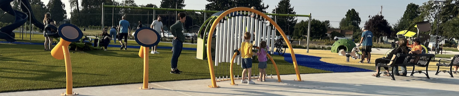
Join us for a Community Park meeting put on by the city of Eugene on August 25th from 6 to 8 pm. The meeting will be the second community workshop to help determine what to do with the 35 acres near Madison Middle School.
You can get updates like the following from LTD by joining the email list on this web page – Santa Clara Transit Station. Look for the green tab near the top right if you visit the LTD page.
August 3 LTD update:
Current Status: Construction
During the month of July, significant progress was made at the transit station and park and ride. At the driver relief building, the concrete slab was poured, the framing was completed and the electrical and plumbing rough-in began. As we enter August, electrical, plumbing and mechanical work will continue in the building and structural steel will be installed.
At the platform area, the concrete footings for the shelters were poured and electrical conduit for lighting was installed. The new shelters are currently being fabricated and are planned to be installed at the end of August.
The concrete curbs at the park and ride have been installed and work on storm water planters and general grading continues. Concrete curbs and sidewalks will continue to be poured throughout the station in August.
Privately Engineered Public Improvements (PEPI) continued thru July. Conduit for the new traffic signal at the intersection of River Road and Green Lane was bored underground in July. The traffic signal pole foundations will be installed over the month of August while the actual traffic signal poles and arms are planned to be installed in September. In early August along Green Lane, EWEB will be installing electrical infrastructure underground and removing several poles. Following EWEB’s infrastructure install, construction efforts will begin along Green Lane and are expected to last two months. Green Lane will be stripped of the current asphalt and a new base will be constructed for the road. New asphalt will be laid and a sidewalk will be installed along the north side of Green Lane. During construction hours, Green Lane will be open to one-lane traffic. Flaggers will be on site to direct traffic around the construction. Outside of construction hours, Green Lane will be open for two-way traffic. The curbs for the new Elementary Lane were poured during July. In August, the sidewalk along the western side of Elementary Lane will be poured.
Traffic Impacts: Green Lane will be open to one-lane traffic from River Road to the east end of the Santa Clara Transit Station during construction hours of 7:30 a.m. to 4:30 p.m. Flaggers will be directing traffic around the road construction; drivers, pedestrians, and bicyclists are encouraged to use caution when traveling on Green Lane. Outside of construction hours, Green Lane will be open for two-way traffic.
PROJECT OVERVIEW
In 2015, LTD purchased an 8-acre undeveloped parcel along River Road between Hunsaker Lane and Green Lane to pursue the design and construction of the Santa Clara Transit Station. This site was selected because the property allows for flexible development of a transit station and Park & Ride. The site provides sufficient space to allow for maximum maneuverability of buses and for better access for riders, pedestrians, cyclists, and people who use mobility devices. The design includes 6 bus bays, 55 parking spaces at the adjacent Park & Ride, on-street parking, secure bike parking, covered station platforms, and a small driver relief building.
On July 28, 2020, the Lane County Board of Commissioners issued a temporary order (effective August 1, 2020 through August 1, 2022) to reduce the posted speeds to 25 mph on Hunsaker Lane and 30 mph on Beaver Street. Lane County staff will update the signage in the coming weeks. This change is intended to improve safety, in combination with physical changes to the roadway. Later this month (August 2020) the corridor will be repaved and restriped to create a wider shoulder on the south side of Hunsaker Lane.
More improvements are planned for the spring of 2021, such as the installation of vertical delineators installed between the wider shoulder and vehicle travel lane, a pedestrian-crossing flashing beacon and construction of a multi-use path along the Delta Sand and Gravel frontage. The delineators will restrict parking on the shoulder in some areas. In the coming months, staff will be reaching out to affected property owners.
We will continue to update you as more details become available. Please contact Becky Taylor, Senior Transportation Planner, at becky.taylor@lanecountyor.gov or 541-255-5761 if you have any questions.
SCCO recap:
Reduced speeds through August 1, 2022
Updated signage
Repaving & restriping
Pedestrian-crossing flashing beacon
Multi-use path along the Delta and and Gravel frontage!!!


 Follow us on Facebook